 |
 |
|
|
|
|
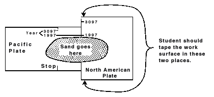
Contributed by: California Systemic Initiative Assessment (CSIA) Description:In this performance task, students use cardboard models of the North American and Pacific plates and sand to investigate what happens when there is an earthquake or movement along the boundaries of the plates.Framework References: California Science Framework, 1990; Chapter 4, Earth Science,
Section B, Geology and Natural Resources. E-1 The Earth has changed through time. E-3 Geological and geomorphic processes explain the evolution
of the Earth. National Science Education Standards:8 D ESS 1: Structure of the Earth System: Grades 5-81.2 Lithospheric plates on the scale of continents and oceans constantly move at rates of centimeters per year in response to movements in the mantle. Major geological events, such as earthquakes, volcanoes, and mountain building, result from these plate motions. 8 A SI 1: Abilities necessary to do scientific inquiry:
Grades 5-8 (Use the "hot" link on the PALS home page
to check the full text of related National Science Education Standards,
if desired.) The Physical Setting: Processes that shape the Earth Benchmark 4C: Grades 9-12 The solid crust of the earth--including both the continents and
the ocean basins--consists of separate plates that ride on a denser,
hot, gradually deformable layer of the earth. The crust sections
move very slowly, pressing against one another in some places, pulling
apart in other places. Ocean-floor plates may slide under continental
plates, sinking deep into the earth. The surface layers of these
plates may fold, forming mountain ranges. National Council of Teachers of Mathematics:AL1: Understand patterns, relations and functions:
PS2: Solve problems that arise in mathematics and in
other contexts: Geological, geomorphic processes explain the evolution of the
earth. Surface features are formed at plate boundaries. Erosion
plays a major role in changing surface features. Mountains form along the boundaries of plates. Two plates meet, and the plate that is denser (usually the oceanic plate) tends to sink and goes under the other plate. As the plate begins to sink, the edges tend to crumble a bit. The edges of the "land" plate also begins to crumble. As more and more of the ocean plate sinks, more crumbling from both plate edges occur. These "crumbles" begin to pile up and form mountains. This type of plate boundary is called subduction. It is also referred to as a subduction zone because this occurs over a large area at any given time. These mountains are also related to the explosive kind of volcanoes that form at these boundaries. The San Andreas Fault is one of the longest faults in the world.
It occurs along the coast of California for more than 500 miles.
It is what geologists call a strike-slip fault where the movement
is horizontal-one plate moves past the other. Generally speaking,
the San Andreas Fault marks the boundary between the Pacific crustal
plate and the North American plate. The Pacific plate is moving
northward relative to the North American plate. This is occurring
at the rate of nearly 5 centimeters per year. This is not very fast
for us, but it is fast for geologic time. The Pinnacles mountains were formed in the Mojave but some of
them were moved north to become part of the Pinnacles of San Benito/Monterey
County because they were formed at a time when the two plates were
in different positions. Materials for The Fault Line:
|