|
8th Grade Performance Task
Contributed by: Kentucky Department of Education (KDE)
PERFORMANCE ASSESSMENT STUDENT INSTRUCTION/RESPONSE
FORM
TASK: M/S 1 "Mapping The Blue Part"
STUDENT NAME: _________________________________________
SCHOOL NAME: __________________________________________
GENERAL INSTRUCTIONS:
Your task is to deteremine the location of specific
features of the simulated ocean floor. The features include the
continental shelf, continental slope, an ocean trench, and mid-oceanic
ridge.
You may use up to 20 minutes to complete the "Group
Instructions" given below.
MATERIALS:
- black box with simulated ocean floor and scale
- height finder with sliding ring
GROUP INSTRUCTIONS:
You will have approximately 20 minutes to complete steps 1 through
3 as a group.
- Begin height readings by inserting the height finder at the
coordinate (H-1). To determine the height, measure the distance
(in centimeters) from the BOTTOM of the sliding ring to the TOP
of the height finder by using the scale on the right side of the
box. Each member of the group should record the measured height
on his/her own grid.
- Continue taking and recording height reading for all of the
points in column "H".
- When you have completed column "H", you are to take
record height readings for all of the points in row "12".
After you finish steps 1 through 3, you will open this booklet
and answer 4-7 on your own.
You will have approximately 25 minutes to complete questions
4-7 on your own.
-
Using the data you have collected, produce graphs
which represent a profile of the ocean floor.
-
Thinking about the features of the ocean floor:
continental shelf, continental slope, ocean trench, and mid-oceanic
ridge. Using your readings, make a "map" of the ocean
floor, identifying the possible locations of ocean floor features.
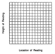
Use the rectangle below for your map. Label the coordinates
along the edges to show the location of these features. What
additional readings would you take to verify your inferences
(ideas)? Why would you take these readings?
_________________________________________________________________________________
_________________________________________________________________________________
_________________________________________________________________________________
_________________________________________________________________________________
- What are some real life applications of mapping the ocean floor?
What benefit could these applications provide?
_________________________________________________________________________________
_________________________________________________________________________________
_________________________________________________________________________________
_________________________________________________________________________________
- If you were an oceanographer wanting information concerning
the ocean floor would you use this method? Why or why not? What
additional investigations would you use to map the ocean floor?
_________________________________________________________________________________
_________________________________________________________________________________
_________________________________________________________________________________
_________________________________________________________________________________
|